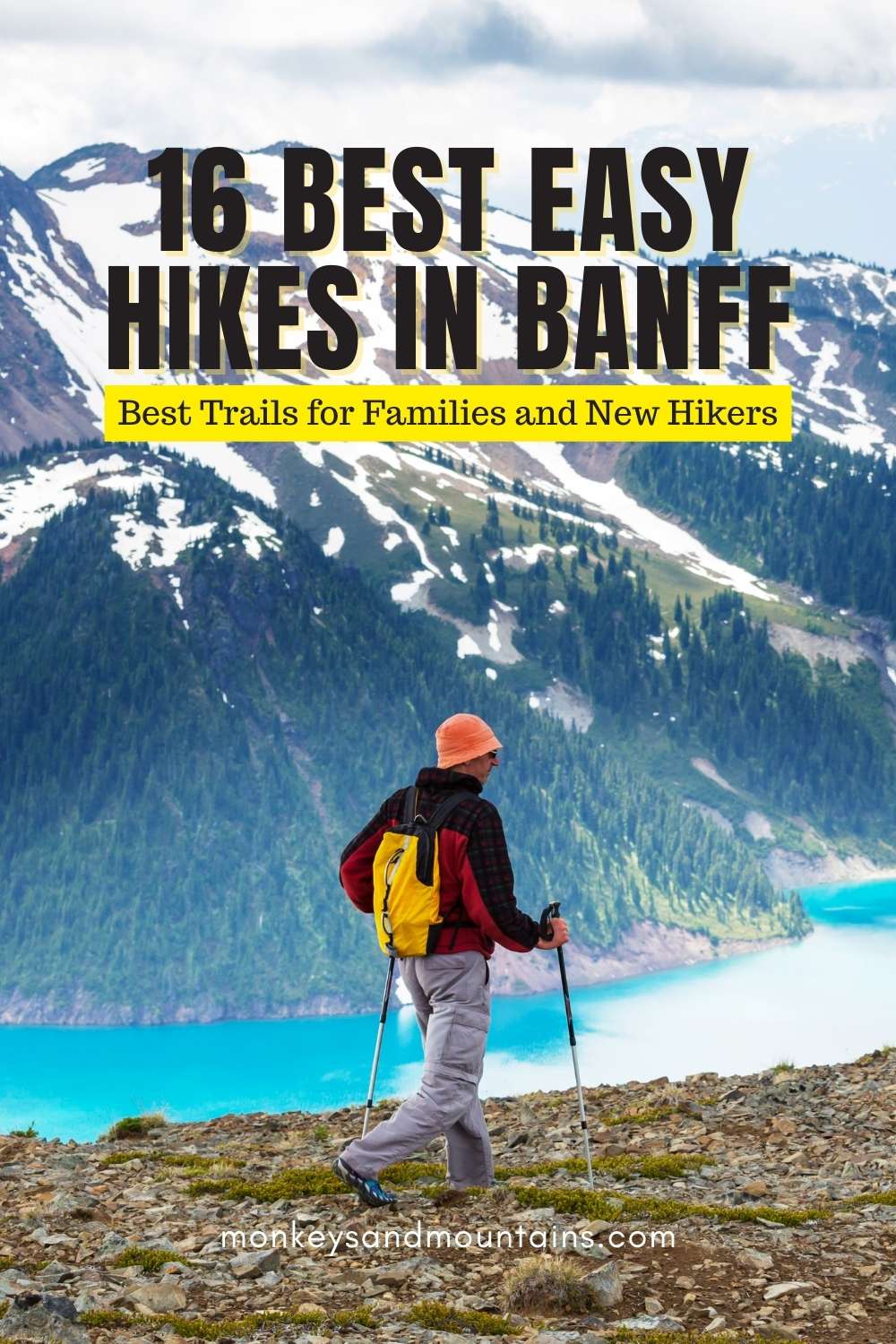
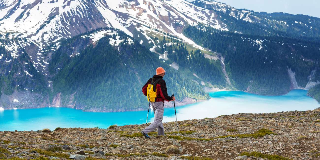
The best easy hikes in Banff that are perfect for families and new hikers. There are an incredible 1600 km (1000 miles) of hiking trails in Banff so it can be hard to know where to start.
Table of Contents
Some of them you can even start hiking from downtown Banff or are just a few minutes away. Even though it’s one of the largest national parks in Canada, you don’t have to spend hours driving around trying to find an easy hike.
As someone who has done well over 100 hikes in the area at all times of the year, you’re in good hands. While there are a ton of challenging hikes in the area, there are also some great easy hikes in Banff that are perfect for new hikers and when hiking with kids.
Here are the 16 best easy hikes in Banff, in my opinion, so that you’ll know which ones are most worthy of checking off your hiking bucket list first.
Best Easy Hike in Banff for the WOW Factor
Johnston Canyon Trail Hike
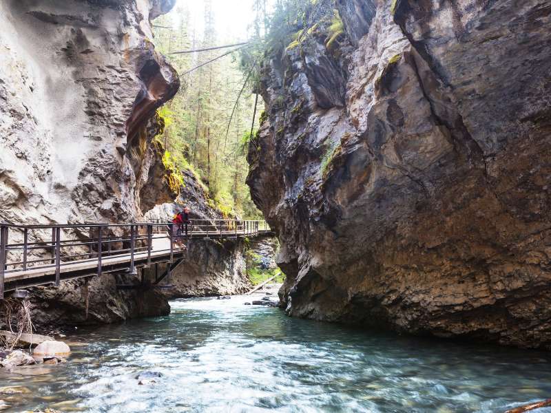
One of Banff National Park’s most popular trails for an easy day hike is the Johnston Canyon trail. The spectacular view of the dramatic canyon and waterfalls attracts a large number of visitors throughout the year.
During winter, the waterfalls freeze when it’s cold enough, making it even more spectacular. The hike to Johnston Canyon is a great choice at any time of year, but especially in winter. See our Best Winter Hikes in Banff for more info on doing this hike in winter.
The hike starts as a fairly level trail through the forest. It doesn’t take long into the hike before you can see ice clinging to the canyon walls if you’re hiking it in winter. . After twenty to thirty minutes, you will come to a fork in the trail.
Go right first to see the Lower Falls, with a deep pool that has been created by the plunging water. Across the bridge, a natural tunnel leads to a viewing platform just meters from the lower falls.
Going back to the fork, take a left and head uphill towards the Upper Falls. This junction is another area where it can get slippery. The trail to the upper falls is a bit more rugged. It climbs out of the canyon, gaining more elevation on several switchbacks.
As you hike through the forest, it leads back to the river again and crosses over more catwalks. You’ll pass by sets of smaller waterfalls along the way before reaching the impressive upper falls.
If you only do one easy hike in Banff, I would recommend Johnston Canyon.
Insider Easy Hiking in Banff Tip: If you’re hiking in winter, I recommend buying microspikes that you can wear over your boots to make the trek much more enjoyable.
- Trail Length: 5.1 km
- Elevation Difference: 120 m
- Trail Type: Out and back
- Trailhead: Johnston Canyon Parking Lot
Directions to Trailhead: To get to the starting point of Johnston Canyon hike from Banff, head west on the Trans-Canada Highway towards Lake Louise.
You can take the scenic route (which I highly recommend as there’s also a good chance of seeing wildlife on the road), the Bow Valley Parkway exit (#1A) and drive along this road all the way to Johnston’s Canyon (18.1 km).
Otherwise, take the more direct route, the Trans-Canada all the way to Castle Mountain Junction and drive 5.5 km.
Easy Hikes in Banff From the Town Center
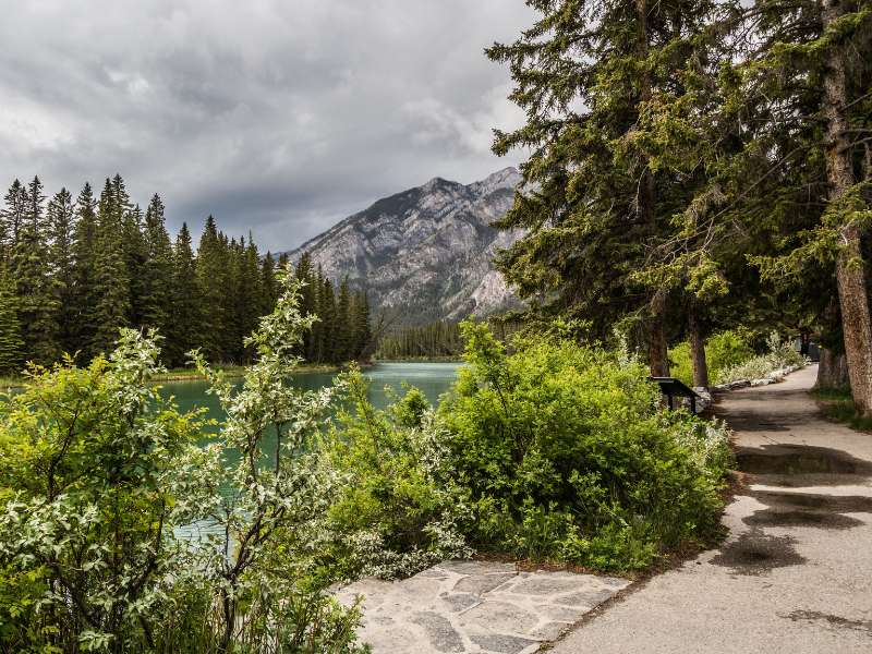
Hike to Bow Falls Viewpoint
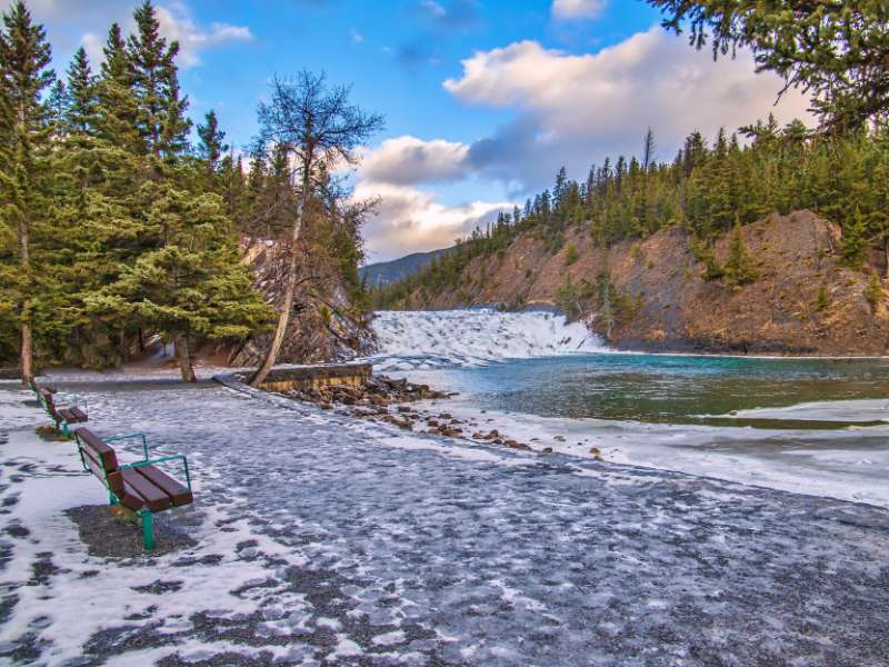
The Bow River Trail offers visitors to Banff a chance to explore one of the most beautiful parts of the town. It’s a short and scenic trail along the riverbank to view the crystalline waterfalls. It follows through a forested area along the Bow River.
There are some nice viewpoints along the way of the river and surrounding peaks, with Mount Rundle in the background. There are benches along the way to rest and take in all the mountain summits.
- Trail Length: 3 km
- Elevation Difference: 50m
- Trail Type: Out and back
- Trailhead: Just before the Bow River Pedestrian Crossing in downtown Banff
Hike to Hoodoos Viewpoint
The Hoodoos Trail is an excellent choice for hiking with children with families and dogs. With minimal elevation and unrivalled views of the area, you won’t be disappointed with this easy hike in Banff that leads to a great view of the hoodoos, so the focus isn’t just on hiking.
It starting at the Surprise Corner parking lot, where you’ll want to take in views of the famous and historic Fairmont Banff Springs Hotel.
Take the dirt path from the parking lot, descending to the shores of the Bow River. Enjoy the forest as the trail winds through the woods alongside the river, offering glimpses of the imposing Mount Rundle.
On your left, you will see the backside of Tunnel Mountain, and if you are lucky, you’ll be able to spot some rock climbers scaling the walls above you.
Continue along the shores of the river and dip your toes or more in if you dare! You know I’m a big fan of icebaths. The Bow maintains frigid temperatures all year round, even in summer.
You’ll begin to gain elevation after leaving the riverside. Some well-maintained stairs will bring you up to a bench on Tunnel Mountain.
Here, there are several viewpoints and interpretive exhibits offering information about how the Hoodoos were formed. From here, return the way you came or cross the street and explore some of the Tunnel Mountain trails.
- Trail Length: 10 km
- Elevation Difference: 305m
- Trail Type: Out and back
- Trailhead: Surprise Corner parking lot
Directions: To get to the Hoodoos Trail trailhead, you’ll need to find your way to Surprise Corner in the Town of Banff. Take Banff Avenue towards the Bow River bridge and turn left onto Buffalo Street.
Follow the road up the hill until you come to a pedestrian crosswalk, where a small parking lot is on your right. Park here if you have chosen to drive. You can walk here from Banff town center, taking the Bow River Trail or Buffalo Street.
Easy Hikes in Banff Close to the Town Center
Hike to Sulphur Mountain / Cosmic Ray Station
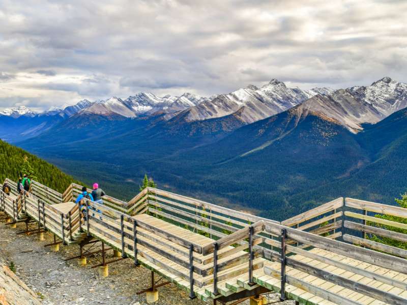
This is admittedly much more of a walk than a hike and is perfect for families with young children. Take the Banff Gondola to the top of Sulphur Mountain. Kids will love the gondola ride as well which makes it a top easy hike in Banff if you have young children.
From there you can enjoy stunning panoramic views of the Canadian Rocky Mountain peaks, including Mount Rundle.
This super easy, yet incredibly scenic route follows the mostly paved and wooded boardwalk trails that start at the top of the Sulphur Mountain Gondola.
The boardwalk is flat, and there are only a few flights of stairs. You won’t believe all the incredible views of the Bow Valley, Banff Town Center and Mount Rundle along the interpretive boardwalk.
Insider Easy Hiking in Banff Tip: It’s best to come here on a clear day since this peak is normally above the clouds. You won’t see anything if you do it on a cloudy day. You can also enjoy the view from the cafeteria at the top of the gondola.
While it is possible to hike up Sulphur Mountain, it’s definitely not an easy hike. Although I recommend it if you’re up for the challenge.
- Trail Length: 1 km
- Elevation Difference: 35 m
- Trail Type: Out and back
- Trailhead: Banff Gondola
Directions to Trailhead: To get to the Sulphur Mountain trailhead, take the road from Banff Towncetner to the Banff Gondola.
Hike to Two Jack Lake Trail
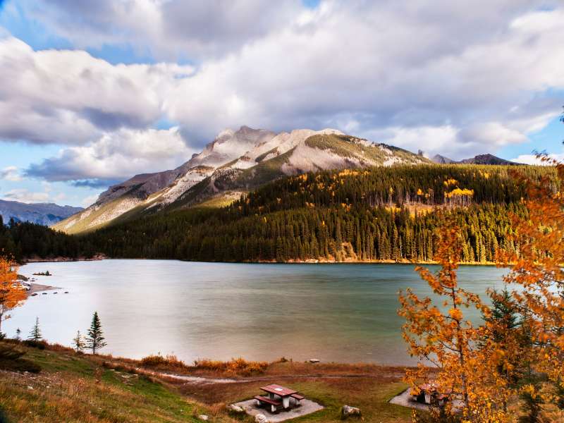
Just a five-minute drive away from Lake Minnewanka and Johnson Lake is Two Jack Lake. Like Vermilion Lakes, it’s another fantastic alpine lake with views of Mount Rundle.
The trail is quite wide and easy to navigate. At the end of the trail, you’ll reach the Cascade Canal. Cross the bridge and follow the path along the canal. When you reach Johnson Lake Road, you’ve gone far enough.
On a calm day, you can even see the reflection of Mount Rundle in the blue waters. It’s absolutely stunning.
The Two Jack Lake Trail is near the Two Jack Main Campground, so you’re likely to run into other hikers.
In winter, when the lake freezes over, it’s possible to go ice skating on the lake. The lake begins to freeze around December and will remain frozen until the end of May.
- Trail Length: 4.7 km
- Elevation Difference: 303 m
- Trail Type: Out and back
- Trailhead: Two Jack Lake Parking Lot
Directions To Trailhead: To get to Two Jack Lake, take Banff Avenue northbound from the Town of Banff, passing underneath the Trans-Canada Highway. Continue on the road as it becomes Lake Minnewanka Scenic Drive. Pass the Cascade Ponds turnoff and take the next right on the Minnewanka Scenic Drive.
After turning right, continue on this road until you see signs for Two Jack Day Use Area. There will be signs for the Two Jack Lakeside campground and the Two Jack Main campground before reaching the day-use area. Park at the day-use area to begin your hike.
Hike to Stewart Canyon
This easy hike in Banff starts along a flat trail on the shores of Lake Minnewanka. The first part is paved and is the most popular part of the trail. After 15 minutes or so, the crowds thin out, and you’ll enter the forest, but you’ll still have both mountain and lake views.
As you leave Lake Minnewanka, your hike leads to the small rapids of the Cascade River. Hike a bit further until you reach a wooden bridge. Here, you’re standing over Stewart Canyon.
Just 200m past the bridge, you’ll leave the Lake Minnewanka trail and start hiking on the trail to Stewart Canyon. From this point, the scenery is especially beautiful.
Your hike into Stewart Canyon is finished when you reach the junction of another mountain stream flowing into the Cascade River. There are lots of large rocks to sit on and revel in the incredible mountain views while having a snack.
- Trail Length:7.6 km
- Elevation Difference: 260 m
- Trail Type: Out and back
- Trailhead: Lake Minnewanka Parking
Directions to Trailhead: To get to the Stewart Canyon Trailhead, from Banff, head north on Banff Avenue, passing under the Trans-Canada Highway until you find yourself on Lake Minnewanka Drive. Continue along this scenic route until you arrive at Lake Minnewanka’s day-use area.
Hike to Fenland Trail
Fenland is an ideal easy flat hike in Banff that’s perfect for families. It goes around the evergreen forest near Vermilion Lakes. It takes you past the pristine Vermillions Lakes in the Bow River Valley. Since it is located next to the lakes, it’s a great spot for bird watching and viewing other wildlife in Banff.
- Trail Length: 1.8 km
- Elevation Difference: 55 m
- Trail Type: Loop Trail
- Trailhead: Banff or Fenlands Recreation Center
Directions: From the Trans-Canada Highway, take the exit for the town of Banff. Head towards town and take your second right into the parking lot. There is a trail sign here at the trailhead.
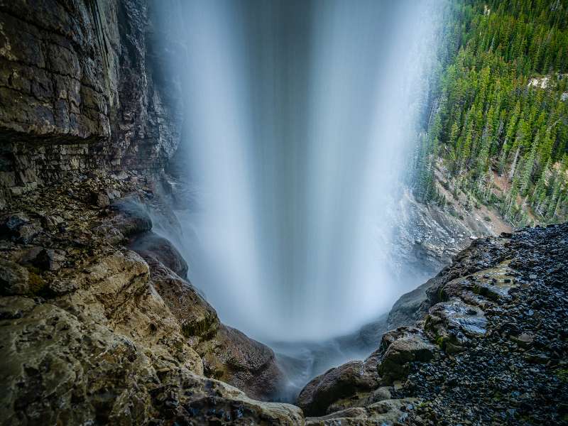
Hike to Cascade Falls
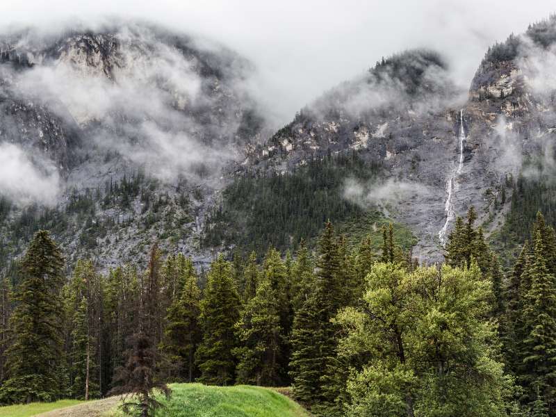
Cascade Falls descending down from Cascade Mountain, is a very popular destination in Banff that has a pretty steady incline on a rocky path. Fortunately, it’s short, which is why I consider it an easy hike in Banff. From there, it’s just a short walk to the falls. It’s not overly strenuous, but it does require a bit of climbing.
From the parking lot, walk towards the metal gate by the hill and walk up towards a trail that begins on the right. Follow the trail up a steep hill as it winds to the right, and within minutes, you reach a set of wooden stairs.
Climb the wooden stairs until you are just underneath the suspension bridge, where you get the first scenic view of Cascade Falls. Be prepared; it can be a bit slippery. Your reward, besides the waterfalls, is the amazing views of the Bow Valley below.
- Trail Length: 1.3 km
- Elevation Difference: 144 m
- Trail Type: Out and back
- Trailhead: Near a large grassy field by the small parking area.
Directions to Trailhead: The trailhead for this hike is located at the end of the road leading to the Trans Canada Highway. Take the Banff/Minnewanka Loop/Boucle Minnewanka exit of the Trans-Canada Highway, the first exit when driving to Banff from the west.
From the exit, turn right on Range Road 115B and follow it for about 300 meters to a dirt parking area.
Hike to Sundance Canyon Trail
The Sundance Canyon Trail is a great hiking option if you are looking for an easy hike in Banff with some cultural flair.
It begins near Cave and Basin National Park and provides stunning views of the Bow Valley. If you enjoy longer hikes, consider extending your trip by taking the Healy Creek Trail.
Beware that this is a shared trail, and you are likely to come across cyclists, horses, and even service vehicles. The paved path is perfect for strollers and families until you reach the canyon. From here, you’ll need to ascend into the canyon, crossing bridges between the canyon walls.
After about 2.0 km, the paved trail becomes a hill, so beware that this can be difficult for kids despite being graded nicely. There is a covered picnic area and washrooms at the top of the hill at the entrance to the canyon.
When visiting the Sundance Canyon trail, be sure to make time for the Cave and Basin National Historic Site. The Cave and Basin are known to be the origin of the Canadian National Parks system, and the historic site provides endless interpretive exhibits and often changing interactive art exhibits.
You’ll be able to explore the cave that was used by Indigenous people for ceremonies and later discovered by railway workers.
The basin site is host to an endangered species of snail only present in Banff National Park. Boardwalks surround the historic site offering interpretive walks through the flowing hot springs that end at the Cave and Basin.
- Trail Length: 9 km
- Elevation Difference: 350 m
- Trail Type: Out and back
- Trailhead: Cave and Basin National Historic Site
Directions: To get to Sundance Canyon from the town of Banff, take Cave Avenue to the end of the road, where you will find parking for Cave and Basin.
Walk from the parking area towards the historic site and continue past the building and signs for the Marsh Loop. You’ll see signs for Sundance Canyon; follow these.
Easy Hikes in Banff: 20 – 30 Minutes From the Town Center
Hike to Sunshine Meadows
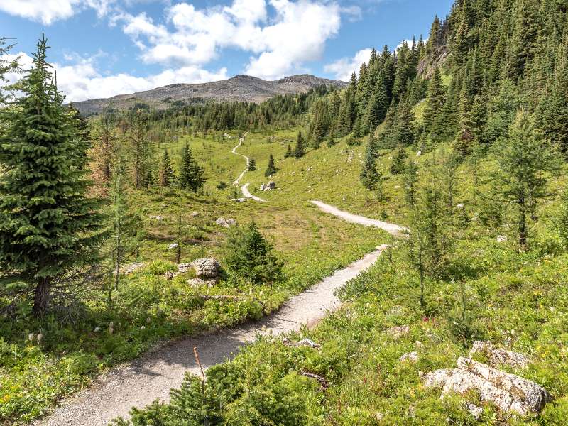
The Sunshine Trail is one of the most popular hikes in Banff. Begin this hike by parking at the Sunshine Base Station and take the gondola up to the start point.
From there, make your way back down to the base of the lift. This is not a hard hike at all, but the gradual ascent from the parking lot will make you sweat a bit. From the resort at the top, turn left at one of the small brown cabins to start the hike to the meadows.
Bear sightings are very common in this region so make sure you bring a can of bear spray. You’ll hike through a variety of ecosystems, including subalpine fir beautiful forests, open alpine meadows, and wetlands. In summer, it’s one of the best places to see wildflowers.
The entire trail offers spectacular scenery, including panoramic vistas of the highest peak in the region at 3,618 meters, Mount Assiniboine standing at 11,870 feet, and spectacular views over the Bow Valley.
Sunshine Meadows is one of my favorite easy hikes in Banff. You can also do more challenging hikes from there as well, like up to Mount Assiniboine.
- Trail Length: 8 km
- Elevation Difference: 309 m
- Trail Type: Loop
- Trailhead: Banff Sunshine Village Gondola
Directions: To get to the Sunshine Meadows hike trailhead, drive 7.7 km west of Banff on Trans-Canada Highway and take the Sunshine Village exit.
Drive 8.2 km on this lovely road to Sunshine Village ski resort. Pick up your gondola ticket from the main building.
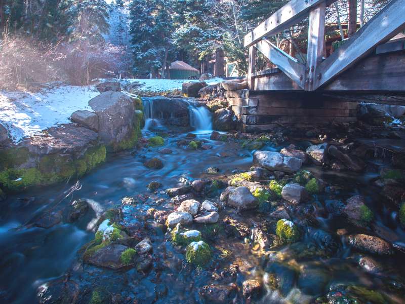
Hike to Silverton Falls Trail
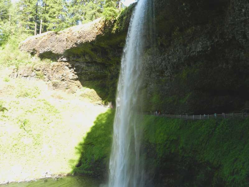
This short hike follows a dirt road that leads to one of the more significant hike in Banff, Rockbound Lake, a more challenging hike. However, it splits off for a quick side trip to Silverton Falls, for an easier hike.
The forested trail begins at the end of the road near the parking lot. From there, it heads north through some trees before heading uphill toward the 164-foot waterfalls.
The trail passes through the forest along a flat terrain to begin and then climbs the remainder of the way along switchbacks to a small area overlooking this gorgeous multiple-tiered waterfall.
A portion of the trail was narrow as it followed along a steep ledge. After reaching the viewpoint, the not-so-steep trail continues downhill to the base of the falls that boasts turquoise water.
The Silverton Falls hike is more of a short walk than an easy hike in Banff. However, it’s worth it. The amazing views of the deep forested valley and mountain range in the distance from this spot still live rent-free in my mind to this day.
If you are looking for something along the Bow Valley Parkway to explore but are short on time, this is an excellent choice. You won’t need much on this easy hike as it will take you less than an hour to complete.
- Trail Length: 1.8 km
- Elevation Difference: 112 m
- Trail Type: Out and back
- Trailhead: Rockbound Lake Trailhead
Directions: From the town of Banff, travel westbound on the Trans-Canada Highway until you reach Castle Junction. Take the exit here with signs for Radium Hot Springs.
Turn right and cross the bridge. Take a right onto Bow Valley Parkway (Highway 1A). After 3.0 km, turn left into the Rockbound Lake trailhead parking lot.
Easy Hikes in Lake Louise
Lake Agnes Trail
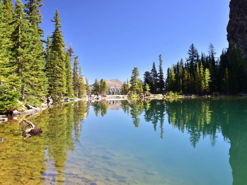
Get to the main Lake Louise (not the ski hill, the actual lake) parking lot early, as it fills up quickly, even midweek. When you leave the parking lot, head in the direction of Lake Louise. Once you’ve arrived, continue hugging the right-hand side of Lake Louise, passing the beautiful Chateau Lake Louise (1,745 m).
Continue going around Lake Louise for a short while before a sign indicates the path leading off to the right towards Lake Agnes. During your ascent, you will get flashes of Lake Louise through the trees.
You will reach Mirror Lake, aptly named for its reflection. It’s a great spot to rest for a few minutes while enjoying views of the Big Beehive reflecting in the emerald water. At Mirror Lake you will want to head to the right, following the signposts to “Lake Agnes”.
After another 1km, you will be at Lake Agnes, a beautiful mountain lake with a lovely little tea house that serves up delicious tea and fresh baked goods. The Lake Agnes Tea House operates 8 am – 5 pm daily from June to October. It’s one of the few easy hikes in Banff that lead to a structure with service. These type of tea houses are quite rare in the Canadian Rockies.
The Lake Agnes Tea House hike is one of the most popular hikes in Lake Louise, thanks to its relatively short distance and lakeside tea house nestled in a scenic hanging valley.
Insider Easy Hikes in Banff Tip: If the Tea House is too crowded, walk to the end of the lake, and you can usually have the place to yourself.
- Trail Length: 7.6 km
- Elevation Difference: 433 m
- Trail Type: Out and back
- Trailhead: Lake Louise Parking Lot
Directions: Drive up the hill towards Chateau Lake Louise and park in one of the lots to the left of the Chateau.
Parking is Limited and is often full by 8 am. Parks Canada offers shuttles from the Lake Louise Overflow Parking Lot.
Hike the Moraine Lake Shoreline Trail
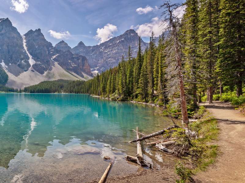
The Moraine Lake shoreline trail is a beautiful hike that features stunning views of the lake and surrounding mountains. This trail is mainly flat, and the Canoe Docks run along the lake’s side and back. It starts at the Canoe Dock parking area and ends at the boat launch. There are no stairs.
This trail is partially boardwalk and partially packed dirt. It is typically at least two feet wide. Most of the trail has a grade of less than 5%, but the steepest sections have up to a 15% grade so you will be breathing heavy, but the steep sections are short and gradual.
There are no major ascents or descents. The track-set ski trail will take you to a viewpoint over Consolation Lakes and the Bow Valley. This is the end of the official trail.
This is another one of my favourite easy hikes in Banff as the scenery far exceeds the effort.
In winter, you’ll want to stop here since beyond this point there can be a risk of avalanches depending on the conditions.
- Trail Length: 2.9 km
- Elevation Difference: 162 m
- Trail Type: Out and back
- Trailhead: Moraine Lake Road
Directions: The Moraine Trail is accessed from the end of Moraine Lake Road near Lake Louise. Note: this road has seasonal closures so check the Parks Canada website before you go.
Easy Hikes in Banff on the Icefield Parkway Between Lake Louise and Jasper
Hike to Athabasca Toe Glacier
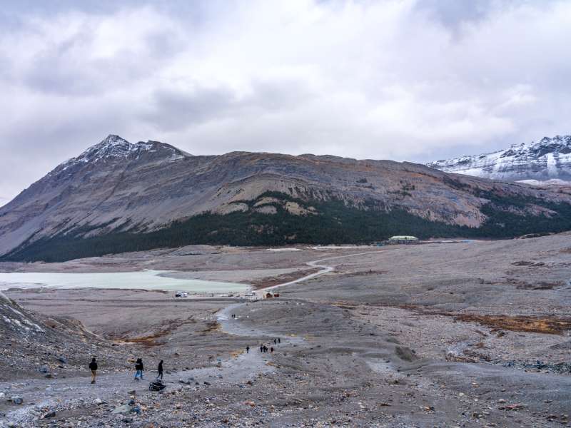
The Icefield Parkway is the most beautiful drive you can do in the Canadian Rockies, and one of the most scenic drives in all of Canada with glaciers and imposing peaks, spectacular scenery and well-maintained trails.
You can hike to the Athabasca Toe Glacier year-round, but it’s an easier hike in summer when it’s not covered in snow.
This trail follows the shortest route from the numerous parking lots. While there are paid options to walk on the glacier, you can do this short hike for free to view the glacier from afar.
The trail is easy to follow, but the area is very rocky with pebbles and stones and glacier debris to walk on.
This super short easy hike in Banff is a great chance to come eye to eye with a glacier in a safe way.
- Trail Length: 1.4 km
- Elevation Difference: 61 m
- Trail Type: Out and back
- Trailhead: Toe of the Athabasca Glacier
Directions To Trailhead: Drive on Highway 93 north to the Columbia Icefield Centre. Instead of turning into the Centre turn left and head on a small road that goes downhill to the bottom of the glacier, passing a small lake en route.
Hike to Panther Falls
Panther Falls is located near Lake Louise but is still in Banff National Park. The falls are formed by the confluence of Nigel Creeks, one coming from the north and another from the south.
Their waters flow over the edge of a cliff between the slopes of Cirrus Mountain and Nigel Peak in the Parker Ridge of the Canadian Rockies.
The trail starts at the parking lot near the Bow Valley Visitor Centre and ends at the viewpoint overlooking the beautiful waterfall.
- Trail Length: 1.3 km
- Elevation Difference: 75m
- Trail Type: Out and back
- Trailhead: Panther Falls Parking Lot
Directions to Trailhead: Take the Icefields Parkway (Highway 93N) towards Jasper, and travel 36.0 km to the Panther Falls parking lot. This parking lot rests on the right-hand side of the highway after a major landmark called “the big bend.”
This is a large curvature in the highway that climbs a steep hill after a 180-degree bend. If you reach Parker’s Ridge, you’ve gone too far.
Bow Peak: Hike an Easy Mountain Summit
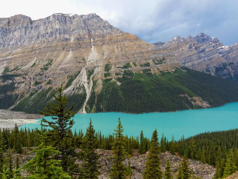
This trail starts at the top of Larch Valley Trail and follows the Continental Divide through the park. It also boasts viewpoints over Peyto Lake before making its way down to the Bow River.
From the main parking lot, take the wide path at the back of the lot to the viewpoint to get a good look at Peyto Lake. The map will show a road that leads to the viewpoint for bus parking, but you will want to take the hiking trail.
At the wooden platforms, you will find some benches and interpretive signs with information about Peyto Lake. Take in the views and look for the fox silhouette shaped by the contours of the lakeshore.
Continue from here on the well-marked trail, where you will likely leave behind most of the tourists. When reaching Bow Summit, you’ll be able to see Peyto Glacier and surrounding peaks.
There’s plenty of scenery and secluded lakes along the route, including views of Mount Rundle, Mount Templeton, and the surrounding mountains. This is a spectacular easy hike in Banff that leads you to a summit without the challenge that reaching most summits requires.
- Trail Length: 6.6 km
- Elevation Difference: 280 m
- Trail Type: Out and back
- Trailhead: Peyto Lake Parking
Directions: To get to Bow Peak, drive north on the Icefields Parkway from Banff or Lake Louise. After passing the entrance to the 93N from the Trans-Canada junction, you will continue for 42.0 km to the Bow Summit parking lot.
If you lose track of distance, it is 4.9 km north of Num-Ti-Jah lodge at Bow Lake. Pull into the Bow Summit parking lot, and your trail begins here.
For even more ideas, check out our Best Winter Hikes in Banff, which also includes some easy hikes.