Explore England’s rich heritage on the Ridgeway Walk as you walk through stunning landscapes and historical landmarks. Get ready to travel back in time on one of the oldest hiking routes in the UK!
The ancient route was established by prehistoric men around 5,000 years ago and takes you on a path through the chalk ridges and hills of the North Wessex Downs and the Chilterns.
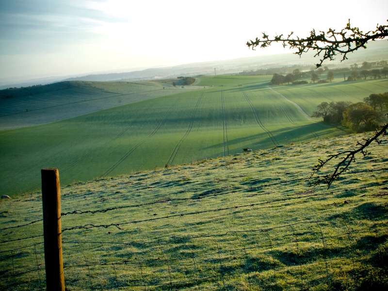
The Ridgeway National Trail takes you through some of the most remote and stunning areas in south-central England.
The 87-mile walk starts from Overton Hill, which is part of the larger Stonehenge, Avebury Henge and Associated UNESCO World Heritage Site in Wiltshire. It follows the chalk hill ridges and provides stunning views over the chalk valleys until you reach Lvinghoe Beacon.
Everything You Need To Know About The Ridgeway Walk
Table of Contents
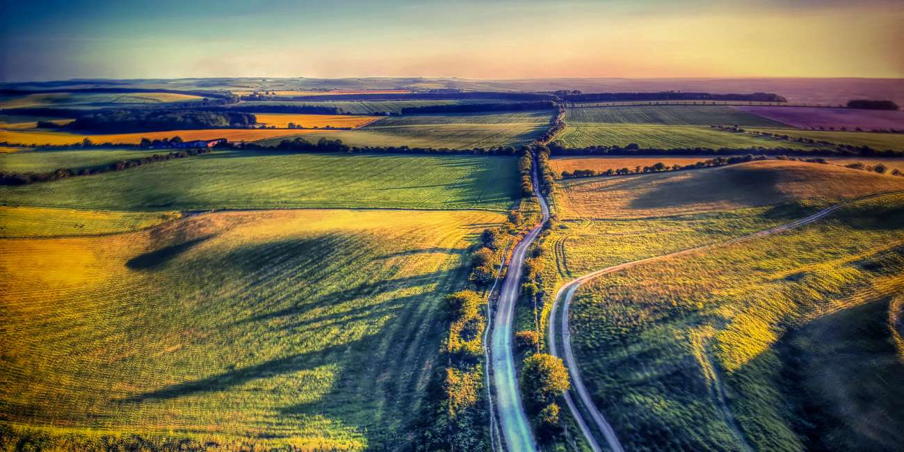
As mentioned before, The Ridgeway Walk is one of the oldest known routes in England. While hiking, you’ll follow the path of your ancestors as you walk the long-distance path taken by many soldiers, herders, and travelers.
You won’t find any soldiers on this remote path anymore, but you will pass plenty of tourists, horse riders, and cyclists along the route.
One of the best things about this hike is how far away from everything you are; it really feels remote.
Some of the highlights and most important archaeological monuments and National Trust sites on the Ridgeway Walk include:
- Overton Hill: The starting point of the trail and which is home to several prehistoric monuments, including a long barrow and West Kennet Avenue.
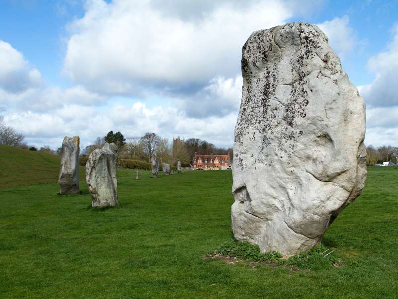
- Avebury: A National Trust site of a Neolithic henge monument containing three stone circles, the largest of which is around 340 meters in diameter. It is one of the largest megalithic monuments in Europe and was built around 2500 BCE.
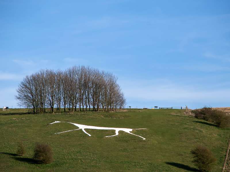
- White Horse Hill: With the Uffington White Horse, a prehistoric chalk figure of a horse that is ~ 3,000 years old. It’s ~ 110 meters long and visible from several miles away, and the Iron Age Hill Fort, both are which are owned by the National Trust.
- Wayland’s Smithy: A Neolithic long barrow and chamber tomb built around 3600 BCE. It’s named after the Saxon god Wayland, who was said to have been a blacksmith and worked at the site. It’s also a National Trust site.
- Barbury Castle: An Iron Age hillfort that dates back to 700 BCE. It’s one of the largest hillforts in the area and offers panoramic views of the surrounding countryside.
- Ivinghoe Beacon: A prominent hill and viewpoint in the Chiltern Hills that offers stunning views over the surrounding countryside.
If you love history, the Ridgeway Walk is a great long-distance path for you, just as Hadrian’s Wall is, if you want to follow in the footsteps of the Romans.
The route was formed 5,000 years ago, which is why you’ll find many historical monuments. But here’s the thing:
It also used to stretch for 250 miles from Dorset to the Norfolk Coast, which would have made it the longest hike in the UK.
The Ridgeway Walk National Trail is one of 16 national trails found in the UK.
Here’s a list of all the national trails in the UK: Cleveland Way, Cotswold Way, Glyndwr’s Way, Hadrian’s Wall Path, North Downs Way, Offa’s Dyke Path, Peddars Way and Norfolk Coast Path, Pennine Bridleway, Pennine Way, Pembrokeshire Coast Path, The Ridgeway, South Downs Way, South West Coast Path, Thames Path, The West Highland Way, Yorkshire Wolds Way.
Your Day To Day Itinerary Guide to the Ridgeway Walk
Now, you’re probably wondering what the day-to-day looks like. So, I’ve broken down the route into eight stages, which is the route I took.
I’ve hiked in the UK for 20 years, have experience in teaching outdoor education and have walked the Ridgeway Walk, so you’re in good hands. I’ll share the highlights, point out tricky or technical sections if there are any, and share my favorite accommodations for walkers each day.
Of course, you might want to adjust the Ridgeway Walk itinerary to suit your needs, but this is the route that most people take:
Stage 1: Walk from Overton Hill To Ogbourne St George
- Start Point: Overton Hill
- Distance: 9 miles (14 km)
- Total Ascent: 195.6 m (642 ft)
- Finish Point: Ogbourne St George
Your hike will start at Overton Hill if you don’t mind camping or stay in Avebury the night before if you’re looking for more comfort, then walk the 3 miles (4.8 km) to Overton Hill.
The Ridgeway Walk heads out towards Barbury Castle, one of the many forts you’ll find along this route. It doesn’t look like much of a castle anymore, but you can see the fort’s remnants there.
One of my favorite parts of this day was looking at the Hackpen White Horse, which is carved into the chalk cliffs.
After a beautiful day hiking, you’ll land at the village of Ogbourne St George, where you can spend the night at The Inn With The Well.
Stage 2: Walk From Ogbourne St George To Bishopstone
- Start Point: Ogbourne
- Distance: 10 miles (16 km)
- Total Ascent: 261.5 m (858 ft)
- Finish Point: Bishopstone
The next leg of your walk can feel strenuous, but it’s not too bad. The route heads toward Liddington Castle, where you’ll reach one of the highest points on the Ridgeway Walk at 277 meters above sea level (909 ft).
From there, you’ll get spectacular views which make the long walk today totally worth it. Eventually, you’ll head down to the village of Bishopstone. You can stay at either Helen Browning’s Royal Oak or Cheney Thatch.
Stage 3: Walk From Bishopstone To Letcombe Regis
- Start Point: Bishopestone
- Distance: 12 miles (20 km)
- Total Ascent: 267 m (878 ft)
- Finish Point: Letcombe Regis
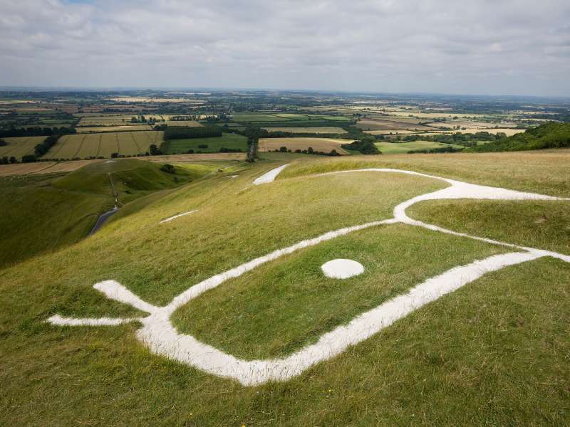
This is a great day if you love historical monuments. It starts with a walk up White Horse Hill, which is home to the renowned Bronze Age Uffington White Horse and the Iron Age Uffington Castle.
This was one of the highlights of my whole trip!
After that amazing section, you’ll head down to Britchcombe Farm, where you can stop for lunch.
You’ll end your day at the village of Letcombe Regis, where you can spend the night at The Greyhound Inn, a charming country pub with great food.
Stage 4: Walk From Letcombe Regis To Streatley
- Start Point: Letcombe Regis
- Distance: 16 miles (26 km)
- Total Ascent: 311 m (1,921 ft)
- Finish Point: Streatley
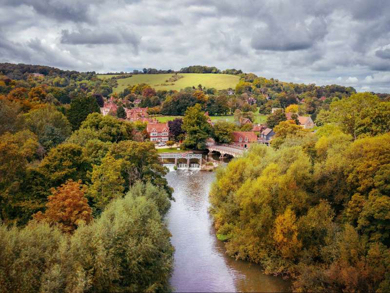
On this section of your hike, you’ll get your first views of Chiltern Hills in the distance (if the weather is clear).
It’s also the point in the walk where you’ll notice the landscape starts to change, with woodland becoming more prominent.
You’ll head to the village of Streatley which is on the west bank of the River Thames. You can spend the night at the YHA Streatley-On-Thames.
Stage 5: Walk From Streatley To Mongewell Park
- Start Point: Streatley
- Distance: 6 miles (10 km)
- Total Ascent: 37 m (124 ft)
- Finish Point: Mongewell Park
One of the funny things about this section is how Streatley and Goring work together. They are technically two villages that reside in different counties, but it doesn’t feel like that.
The route will leave you just behind the North Wessex Downs, which is on relatively flat terrain and surrounded by the River Thames.
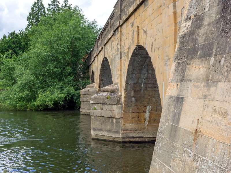
One of my stand-out parts of this walk was the enormous multi-arched viaducts which were built to carry Isambard Kingdom Brunel’s famous Great Western Railway.
Eventually, you’ll end up at Mongewell Park, which is a Civil Parish, where you can stay at The Ridgeway View Campsite. If you don’t fancy camping, you have a view of other options, including The Chilterns View and The George Hotel + Tavern Bar.
Stage 6: Walk From Mongewell Park To Watlington
- Start Point: Mongewell
- Distance: 9 miles (14km)
- Total Ascent: 367 m (1,205 ft)
- Finish Point: Watlington
For the first part of the walk, you will follow the ancient Grim’s Ditch, a beautiful tree-lined section of the Ridgeway.
After a while of walking, you’re clear from the trees, where it opens up to the charming hamlet of Swyncombe before heading to the small market town of Watlington.
There are two places you can spend the night in Watlington, White Mark Glamping if you’re camping or The Fat Fox if you’re looking for a room.
Stage 7: Walk From Watlington To Wendover
- Start Point: Watlington
- Distance: 17 miles (27 km)
- Total Ascent: 528 m (1,732 ft)
- Finish Point: Wendover
This is one of the most challenging sections of the Ridgeway Walk due to the steep ascents and descents along the way.
It starts quickly with a brisk walk through Icknield Way, which is an ancient track that runs from Northfolk to Wiltshire, before going under the M40 motorway.
Halfway through your walk, you’ll pass through the Aston Rowant National Nature Reserve, which is beautiful. You can expect to find plenty of stunning flowers, juniper scrub, and a number of butterflies.
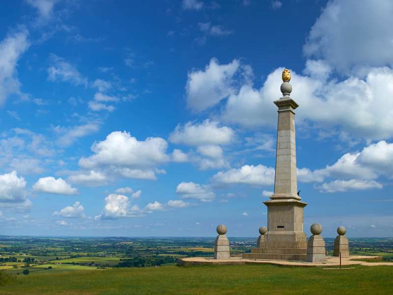
You’ll then reach the top of Coombe Hill, another of the Ridgeway walk’s highest points (260 meters above sea level). You’ll get stunning views over the Vale of Aylesbury in Buckinghamshire.
Your final descent will see you into the town of Wendover, where you can get your accommodation for the night. I stayed at Hale House, which was a stunning little house that included breakfast.
Day 8: Walk From Wendover To Ivinghoe Beacon
- Start Point: Wendover
- Distance: 11 miles (18 km)
- Total Ascent: 381 m (1,285 ft)
- Finish Point: Ivinghoe Beacon
After an excellent breakfast at Hale House, I was ready to take on the final day of my Ridgeway Walk.
The final section is set deep into the woodlands of Chiltern Hills, which made for a glorious day of hiking.
Eventually, you’ll cross The Grand Union Canal, which links to two of the largest cities in the UK, London and Birmingham.
You’ll take one final climb before reaching Ivinghoe Beacon, a prominent hill (233 meters) and landmark in Buckinghamshire. From here, you get panoramic views, marking the perfect end to your Ridgeway Walk.
While this is the official end, you still need to walk the 3 miles (4.8 km) to the market town and civil parishTring. I recommend spending the night in Tring, since it’s classed as an Area of Outstanding Natural Beauty so it’s worth taking some time to explore before departing the next day.
Ridgeway Walk Accommodation Guide
For your easy reference, here is a list of where you’ll want to book your accommodations for the 8-day itinerary:
Arrival Day: Overton Hill
Day 1: Ogbourne St. George. Our Recommendation: The Inn With The Well
Day 2: Bishopstone. Our Recommendations: Helen Browning’s Royal Oak
Day 3: Letcombe Regis. Our Recommendation: The Greyhound Inn
Day 4: Streatley. Our Recommendation: YHA Streatley-On-Thames
Day 5: Mongewell Park. Our Recommendations: The Chiltern View or The George Hotel + Tavern Bar
Day 6: Watlington. Our Recommendations: White Mark Glamping or The Fat Fox
Day 7: Wendover. Our Recommendation: Hale House
Day 8: Ivinghoe Beacon. Our Recommendation: Tring
Frequently Asked Questions About the Ridgeway Walk
How Long Does The Ridgeway Walk Take?
The route isn’t that challenging in terms of large ascents or terrain, so most walkers with a reasonable fitness level should be able to do it.
Most walkers do the 87-mile (140 km) walk between 5-8 days.
Here’s what the mileage looks like day to day:
• 5 Days – 17.4 miles per day (28 km)
• 6 Days – 14.5 miles per day (23.3 km)
• 7 Days – 12.4 miles per day (19.9 km)
• 8 Days – 10.9 miles per day (17.5 km)
One thing to note is these are just estimations; some days, you might walk further than others, but it’s up to you.
You also need to consider that there are many incredible archaeological sites and castles to visit along the route, so you might want to factor this in and spend some time exploring them.
Where Does the Ridgeway Walk Start and Finish?
The Ridgeway Hike starts in Overton Hill, so you’ll have to make your way. there. Unfortunately, it’s not that simple.
Overton Hill doesn’t have a train station, so you’ll have to get to Swindon, which is pretty well connected by public transport.
You’ll have to use the bus service from there, but there’s no direct bus service to Overton Hill, so you’ll have to take a bus to Avebury first.
Luckily, this isn’t too much of an issue because there is not much accommodation in Overton Hill unless you don’t mind camping.
From Avebury, you have two options to reach Overton Hill:
• Take the 42 bus to Overton Hill
• Walk three miles (4.8 km) to the start point
The route finishes in Lvinghoe Beacon. From there, you’ll have to add an extra three miles to your hike and walk to Tring. The town of Tring has a railway station connected to the West Coast Mainline, which connects to Scotland, Birmingham, and London.
Where To Stay Along The Ridgeway Walk?
There aren’t many places to stay in each location, so they fill up quickly. If you’re planning to take on the Ridgeway, make sure you book well in advance.
When Is The Best Time To Do the Ridgeway Walk?
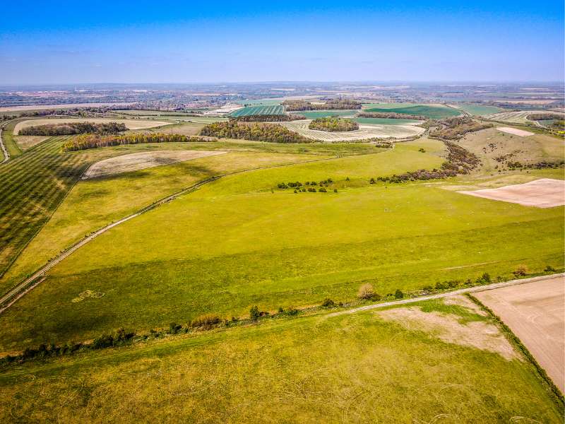
You can walk it this all year round, but be warned, certain sections of this hike can get extremely muddy.
As with any hike in the UK, the best time to go is during the summer months.
But it does have a certain charm in autumn or spring. While I recommend wearing Merino wool at any time of the year when hiking, it’s especially useful if you do this route in the spring or autumn.
What Hiking Gear Do I Need for the Ridgeway Walk?
Here’s our list of recommended trekking gear for a multi-day trek like this.
Plus, I like to bring a good hiking book so I have something to read in the evenings (usually on my Kindle) and record the day in my hiking journal.
And for the ladies who still want to look good while doing this route, check out our hiking makeup tips.
What Should I Eat When Walking the Ridgeway?
While it will be possible to get a meal at your accommodations, ensure you have the proper hiking lunch and snacks. You also want to ensure that you eat a breakfast that will sustain you on your walk.
Related Reading: The Wicklow Way Walking Tour: What You Need to Know
More Information on Walking the Ridgeway Walk
Guidebooks are great sources of information, like this guidebook which includes a route planner, route maps if you’re planning on doing it by yourself.
Final Thoughts & Takeaways on the Ridgeway Walk
The Ridgeway Walk takes you through some stunning countryside locations in the South of England. One of the best things about this walk is how much history and archeological sites you see along the way and how remote it feels.
Plus, it doesn’t have many significant ups and downs, so people of all ages and fitness levels can take on the walk.
