The Turtle Mountain Hike in Crowsnest Pass, Alberta, is unlike any other hike. You’ll hike up the mountain responsible for Frank Slide, the deadliest rockslide in Canada. Needless to say, the challenge is mental as much as it’s physical.
Table of Contents
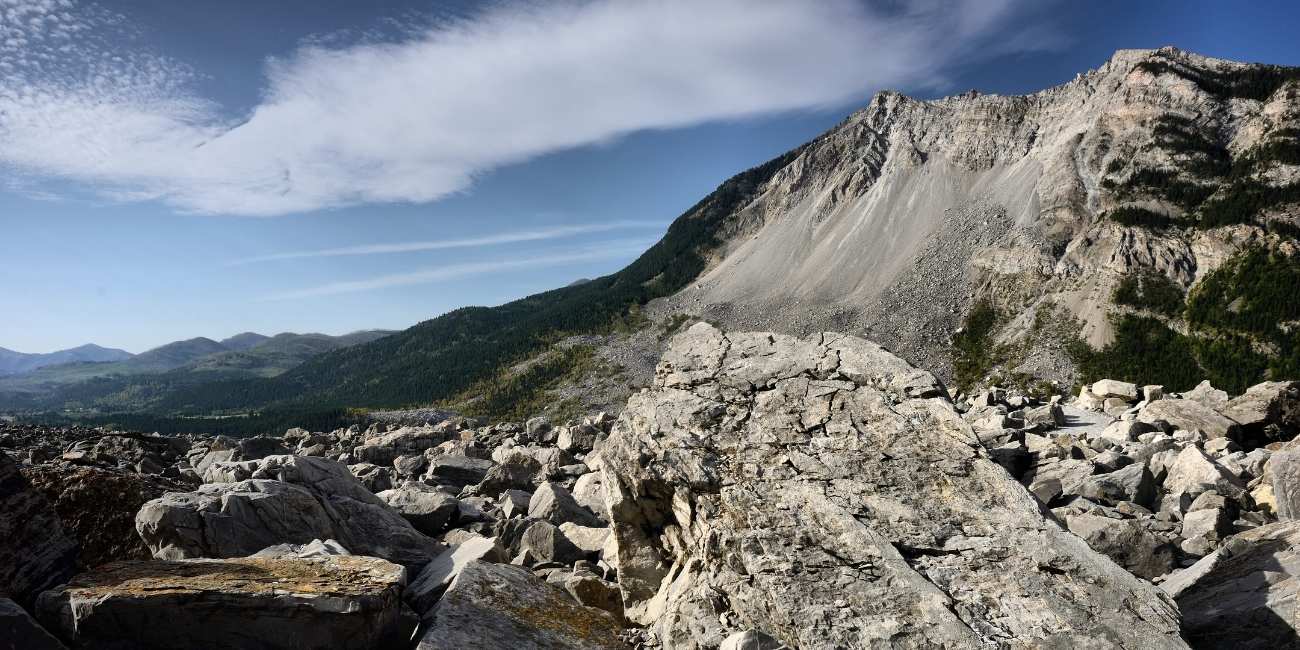
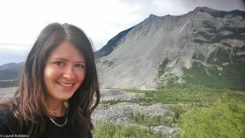
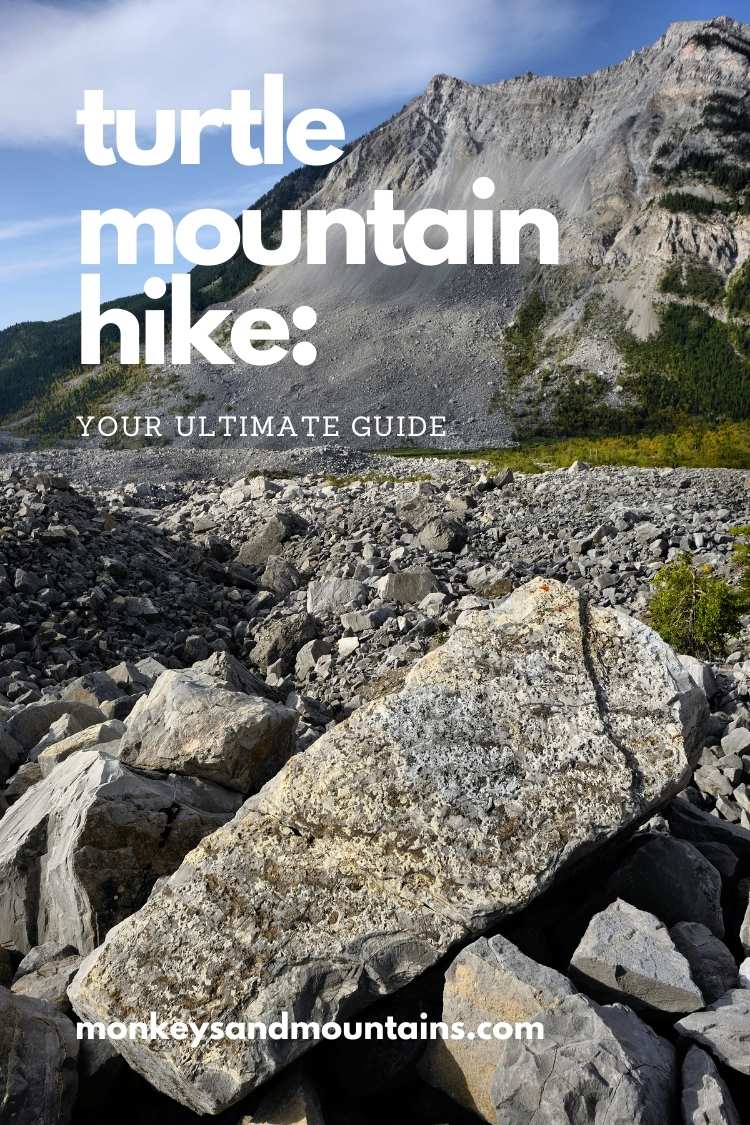
It’s one thing to see 82 million tons of rock piled up at the foot of a mountain. It’s quite another to hike that same mountain.
Although I’ve lived in Europe, first Germany and now Bulgaria, for over 12 years, southern Alberta, Canada, will always be home to me.
I’ve done somewhere between 150 – 200 hikes in the Canadian Rockies, in both Alberta and British Columbia,and I can honestly say that the Turtle Mountain Hike, infamous for Frank Slide, is the most unique hike I’ve done in the Canadian Rockies!
Hiking up the west side of Turtle Mountain is not something you will forget – EVER!
The area of SW Alberta, which includes the Crowsnest Pass, Pincher Creek, Castle Provincial Park and Waterton National Park, is often overlooked by visitors. Instead, visitors head to the better-known national parks of Banff or Jasper. While those parks are incredible, so are the parks and recreational areas in SW Alberta. Trust me, you won’t want to miss out!
History of Frank Slide and How It Happened
In 1903, part of Turtle Mountain collapsed, spreading boulders as big as houses across 3 square kilometres. The rock slide was the deadliest in Canadian history.
An estimated 82 million tonnes of limestone sheered itself off the mountain. A death toll of 70 people in 100 seconds. Most of the bodies were never recovered.
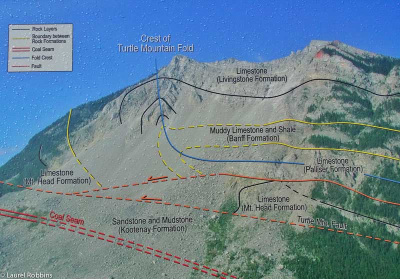
The role of coal mining in the rock slide has long been debated. But scientists currently working on the Turtle Mountain Monitoring Project consider it to be a factor in the 1903 natural disaster.
Related Reading: 9 Ways to Experience the Natural Beauty of Vancouver
Hiking Turtle Mountain for a Bird’s Eye View of Frank Slide
Hiking Distance/Trail Lenth: 7.4 km
Meters of Elevation Gain: 936 m
Highest Elevation: 2100 m
Trail Type: Out and back
Hiking Time: 4 1/2 hours
When to Hike: June to October
Level:
- Difficult to the true summit, the South Peak involving some route finding and some rocky scrambling.
- Moderate if you only go to the false summit, the North Peak
Getting to the Turtle Mountain Trailhead: The trailhead parking is located near 134th Street and 15th Avenue in a subdivision of Blairmore, one of the towns that comprise the Crowsnest Pass.
It starts under a power line, just before a chainlink fence blocking access to an old quarry. There’s no sign, but yellow-painted rocks indicate the trailhead.
Why It’s Freaky Hiking Turtle Mountain
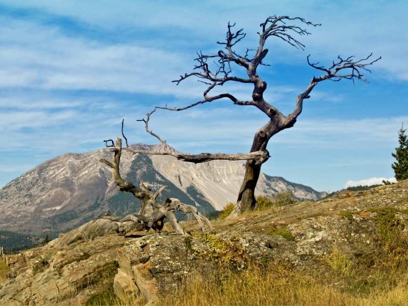
Turtle Mountain is still unstable. Scientists predict that it’s not a matter of if but a matter of when more of it will come tumbling down for Frank Slide 2.0.
The trail starts off as a very steep climb up the spine of Turtle Mountain.
You’ll find yourself clinging to tree branches to brace yourself, especially if the trail is muddy. But it gets less slippery after the first few minutes. And the steepness does relent…in places.
But the good news is that there’s a well-worn, albeit unsigned, trail to the first summit. In my book, an unsigned hike is usually a good sign. Pun intended! And Turtle Mountain is no exception!
Related Reading: Writing-On-Stone: Your Guide to Exploring This Treasure in Alberta, Canada
Recommended Reading: The Best Way to Experience Castle Provincial Park in Alberta
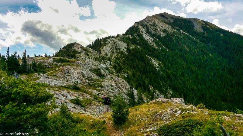
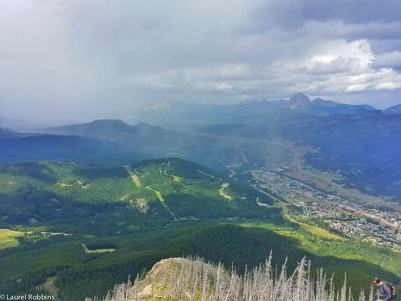
Within minutes you will be able to see the first summit, the North Peak. But there are still no signs of Frank Slide on the other side of the mountain.
For that incredible, not to mention scary, view of the rock slide, you’ll have to continue to just below the true summit. My heart was racing as I took this photo:
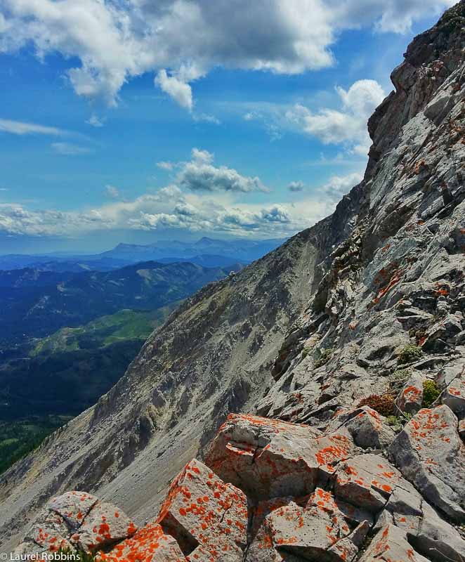
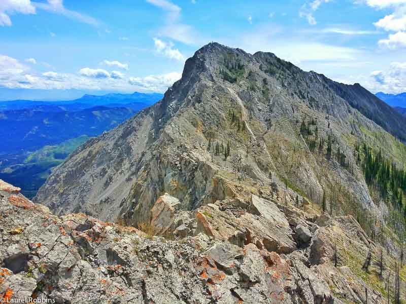
The Turtle Mountain hike turns into a scramble to reach the true summit– meaning you have to use your hands as well to scramble up the mountain, so I recommend that you have experience with scrambling. Otherwise, you can hike up to the false summit, the North Peak without any issues. However, for the best views you’ll want to continue on.
Soon after that, you’ll reach the true summit, the SouthPeak. Expect it to take 1 1/2 to 2 hours.
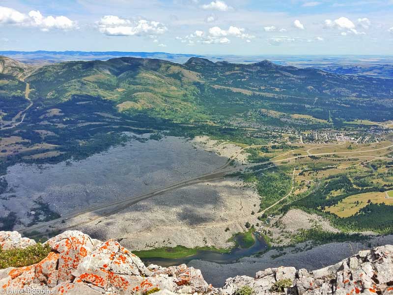
From the true summit, you’ll see exactly how humongous the rockslide was:
This is where your head starts to fill with thoughts like What if it collapses again while I’m on it? Relax and take a deep breath. You are safe. The mountain is continually monitored.
Nobody wants a repeat of 1903. If there were any significant signs of seismic activity, the area would be closed off.
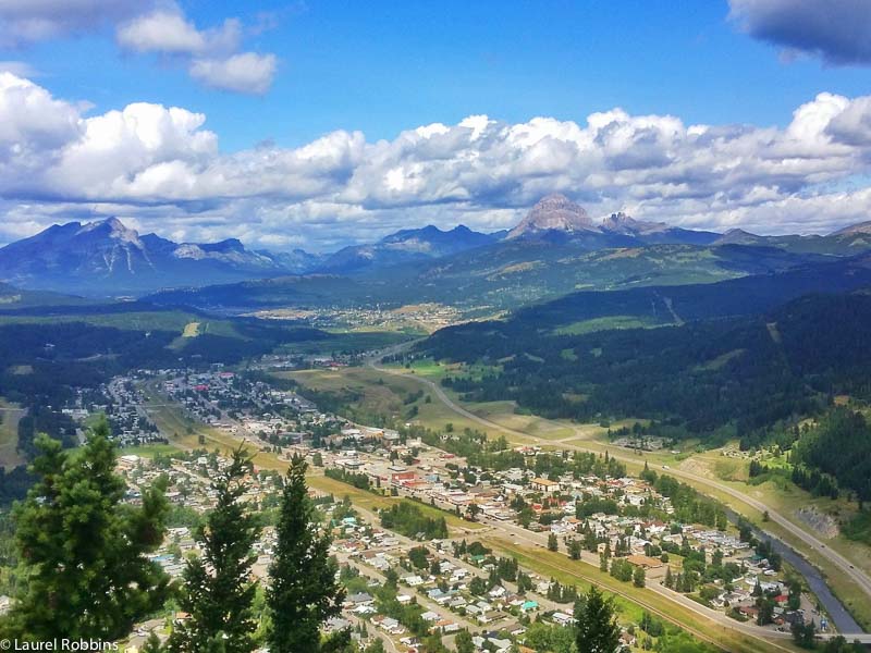
For more positive thoughts, face west for far-reaching fantastic views over the Crowsnest River Valley and over the town of Blairmore and Crowsnest Mountain, another nearby hike to the north!
Crowsnest Mountain is another scramble that I really enjoyed, but with 1200 m elevation gain, it should be attempted only by those with hiking/scrambling experience looking for an adventurous hike.
Related Reading: The Rocky Mountains Canada: The Best Adventures For Everyone
Related Reading: The Best Hiking Journal and 7 Reasons You Should Keep One
The first time I hiked Turtle Mountain several years ago, I continued on.
Trust me, you’re going to want to. However, this time, my now ex-partner and I were forced to turn around due to bad weather.
Related Reading: Things To Do in Jasper: The Top Attractions Not to be Missed
You could literally see the rain moving towards the mountain. And I’m guessing the wind was at least 50km an hour, probably more. High winds are frequent in SW Alberta, so it’s important to be aware of when hiking in this region.
I had difficulty standing without falling over. As hard as it was to turn around, it simply wasn’t safe to continue hiking towards the true summit. The unstable mountain was too much of a risk to proceed.
Hiking to the South Peak of Turtle Mountain
This next part is from the first time I hiked Turtle Mountain. Now, assuming that the weather is on your side, the best part is yet to come – the part that makes this hike truly unique!
But before you can get to that part, you’re going to have to do a bit of a dreaded down climb – about 25 m.
I know, I know, you’ve just spent the last couple of hours climbing up, and now you’re going to have to climb down, only to hike up again!
Trust me, it’s SO worth it!
Ignore the voice in your head that shouts: LOOK AT HOW UNSTABLE I AM! This is truly the fun part of the hike for adventure lovers!
My heart was beating as I visually created my hiking route up Turtle Mountain, only to have it be interrupted by fractures and boulders blocking my way. It’s like a giant puzzle on top of a mountain. Your job is to figure it out. I LOVED, LOVED, LOVED this part!
Try to hike relatively near the top of Turtle Mountain. It is easier going this way. At this point, your heart will be pounding – both from the effort and overcoming the fear that the mountain could collapse at any time – it won’t!
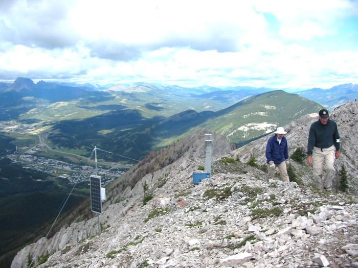
Then, you start to see all the seismic solar-powered monitoring equipment. All of a sudden, another rock slide seems imminent.
Your heart starts beating even quicker. You start listening for the sounds of a rock slide. You’ll convince yourself that you hear the rumbles of Turtle Mountain.
Remember, despite what your eyes are seeing, you are safe – mind over matter! Frank Slide 2.0 isn’t going to happen when you’re on the mountain. All the monitoring equipment is keeping you sage.
Related Reading: Things to Do in Yoho National Park: Why You Should Visit this Canadian Gem
While the second summit, the South Peak, is not far, it’s slow going. It will take you at least 45 minutes to reach it, even though it doesn’t look like it will take that long.
Enjoy it, this is the part that makes Turtle Mountain such a unique hike and the beautiful views will keep you motivated!
You also have the option to continue on a bit further to the helicopter landing pad! And no, not for your rescue, but just because it’s cool.
When you return, try to stay close to the top of the mountain until you reach the path again. I made the mistake of descending too quickly.
Trust me, it’s a natural tendency to want to put some distance between you and the monitoring equipment and black hole crevices. But it’s actually easier if you hike closer to the top.
Figure your way down through the maze. Take your time and go slowly.
Related Reading: The Best Hiking Journal and 7 Reasons You Should Keep One
Most of all take in a few deep breaths of fresh mountain air. You have just summited the most unique mountain in the Canadian Rockies!
Visit the Frank Slide Interpretative Centre
You’ll definitely want to stop by the Frank Slide Interpretive Centre either before or after your hike up Turtle Mountain. It’s worth checking out the exhibitions. But even if you don’t go inside, there is a short interpretive loop outside, which is informative. There is also the Crowsnest Pass Public Art Gallery nearby.
The Frank Slide Lookout is also a good choice for giving you one of the best views of Frank Slide – without having to climb up a mountain. It’s one of several short cycling/walking routes with a paved path you can choose from. This is a good option if you’re looking for an easy yet fascinating hike.
Related Reading: Why a Visit to Head-Smashed-In-Buffalo-Jump is a Must
Other Nearby Hikes in the Crowsnest Pass and Hiking Conditions
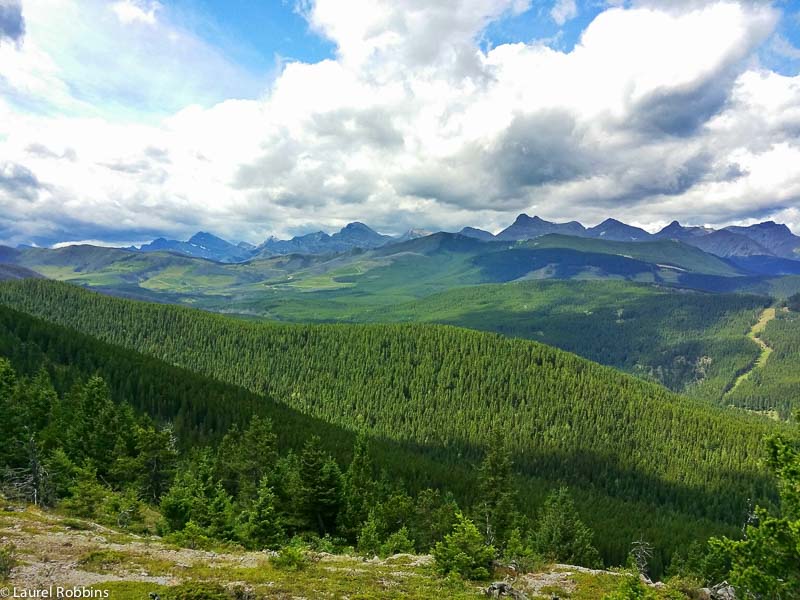
- You could easily spend a week hiking in the area and the nearby Castle Wilderness. Table Mountain is one of my favourite hikes in the area.
- Crowsnest Mountain is a difficult but stunning hike that I’d recommend for experienced hikers with scrambling experience.
- Weather can change very quickly in the mountains as it did on my second hike to Turtle Mountain. Be prepared to turn around if conditions become unsafe.
- SW Alberta is famous for its wind, so expect the summit to be very windy and bring a hiking jacket that breaks the wind.
Now you know everything about the Turtle Mountain hike for views over the Frank Slide valley. Would you do it?
Disclosure: My visit to the Crowsnest Pass was made possible by Travel Alberta. I climbed Turtle Mountain on my own initiative. As always, all opinions are my own. This post has been updated and republished.
